| Internet GIS and Water Resource Information |
|
ABSTRACT
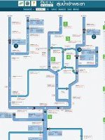
GIS is Geographic Information System, a computer system capable of integrating, storing, editing, analyzing, sharing and displaying geographically referenced information. At present, GIS is not only limited to cartography but also involves in various activities i.e. scientific investigation, natural resource management, environmental impact assessment, etc. Internet GIS allows more information sharing as many users can access GIS at the same time. Another progress in GIS is GIS/MIS where non geographical information (customized to users’ purposes) regarding the particular area was overlaid with GIS. Internet GIS/MIS is useful for water resource management as it gives users better understanding of the overall picture i.e. GIS: locations of rivers/basins, topography of the flooded/drought areas, linkages of geographical factors and natural disasters occurred and MIS: water demand and supply thus gives users the ability to find best solution for each area and manage water resource in a sustainable manner. P. Deeprasertkul, R. Chitradon |
| แก้ไขล่าสุด ใน วันอังคารที่ 02 ธันวาคม 2014 เวลา 15:50 น. |


