ติดตามสภาพอากาศ
เป็นการรวบรวบข้อมูลต่างๆ ที่เป็นประโยชน์ในการติดตามและคาดการณ์สภาพอากาศของประเทศไทย เพื่อการบริหารจัดการทรัพยากรน้ำประเทศไทยอย่างมีประสิทธิภาพ อีกทั้งยังสามารถช่วยลดความเสี่ยงและความเสียหายที่อาจเกิดขึ้นได้จากผลกระทบของการเปลี่ยนแปลงและความแปรปรวนของสภาพอากาศ ประกอบได้ด้วยข้อมูล 4 กลุ่ม ดังนี้
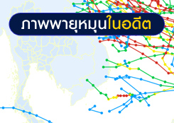
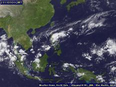
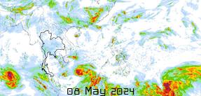
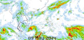
- กลุ่มที่ 1 ข้อมูลสำหรับการติดตามและคาดการณ์สถานการณ์พายุ และสภาพเมฆฝน ณ ปัจจุบัน
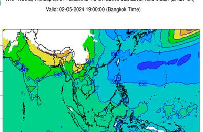
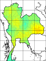
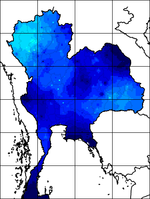
- กลุ่มที่ 2 ข้อมูลแผนภาพการกระจายตัวฃองอุณหภูมิ ความชื้น และความกดอากาศ
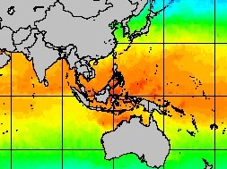
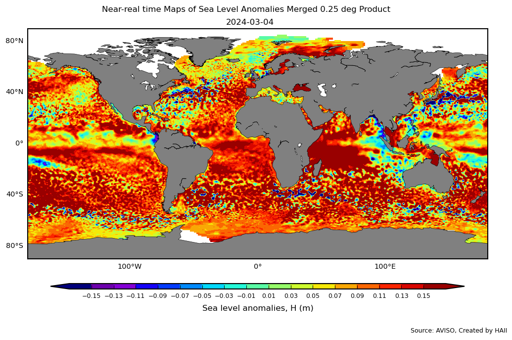
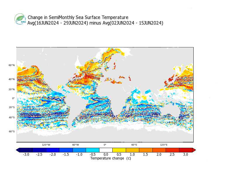
- กลุ่มที่ 3 ข้อมูลสำหรับการติดตามและคาดการณ์สภาพอากาศจากค่าความสูงน้ำทะเลและอุณหภูมิผิวน้ำทะเล
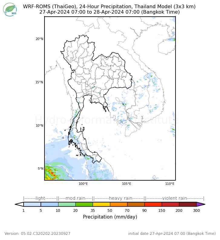
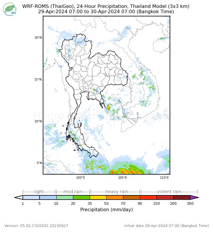
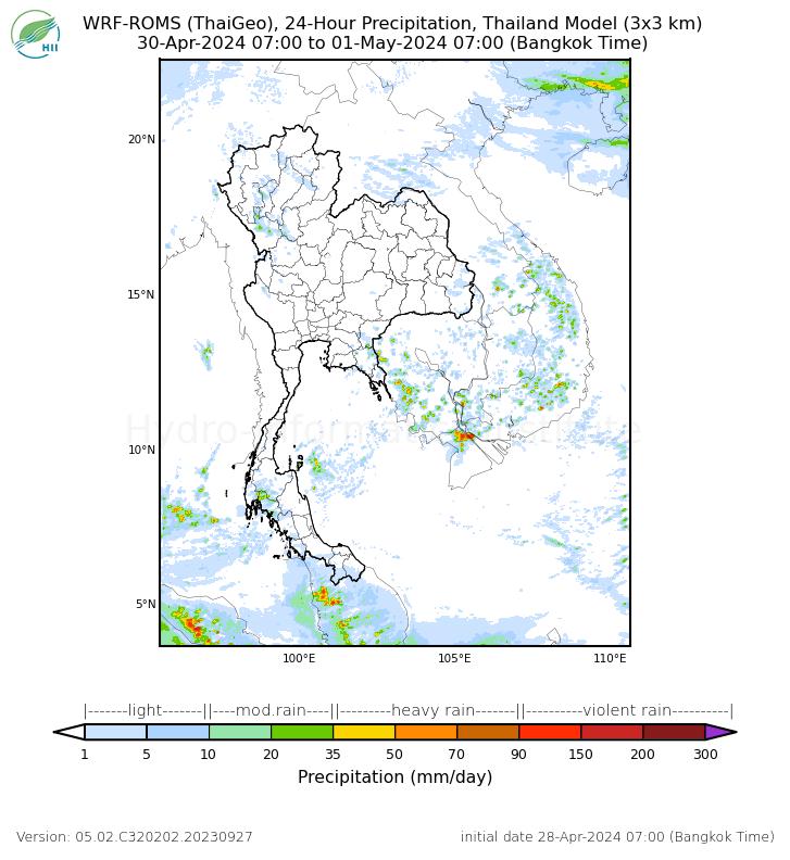
- กลุ่มที่ 4 ข้อมูลสำหรับการคาดการณ์ฝนล่วงหน้า 7 วัน
สถานการณ์ปัจจุบัน
สถานภาพพายุที่เข้าใกล้ประเทศไทยขณะนี้:
ข้อมูลพายุ


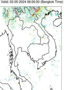
แผนที่แสดงการกระจายตัว
อุณหภูมิ
ความชื้น
ความกดอากาศ
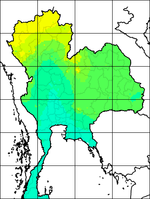
ข้อมูลจากสถานีอัตโนมัติ (ปรับปรุงข้อมูลทุกชั่วโมง) ใช้วิธี Inverse Distance Weight
ด้วยความร่วมมือระหว่าง บริษัท แอดวานซ์ อินโฟร์ เซอร์วิส จำกัด (มหาชน)และ สถาบันสารสนเทศทรัพยากรน้ำและการเกษตร (องค์การมหาชน)
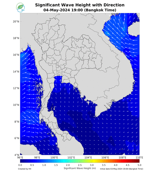
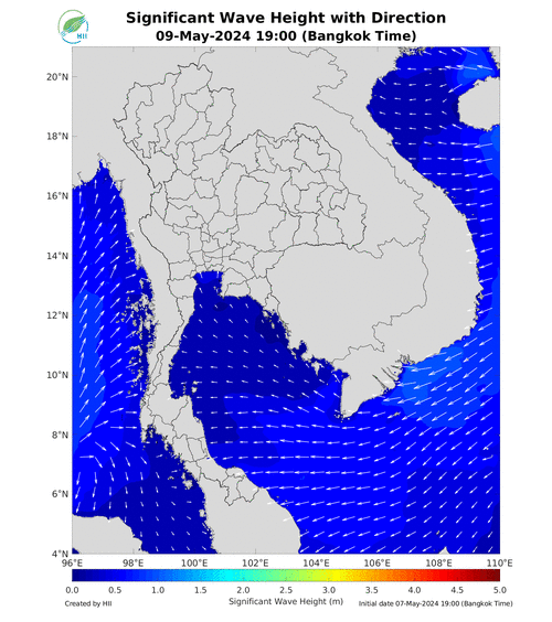
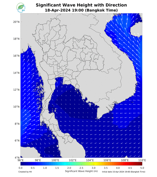
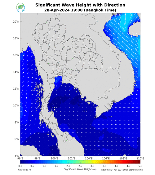
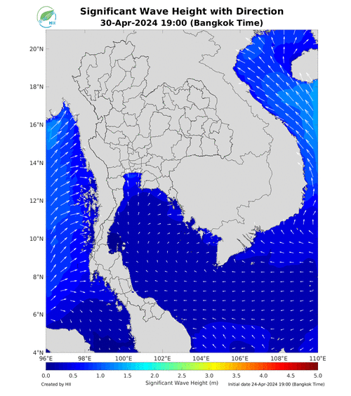
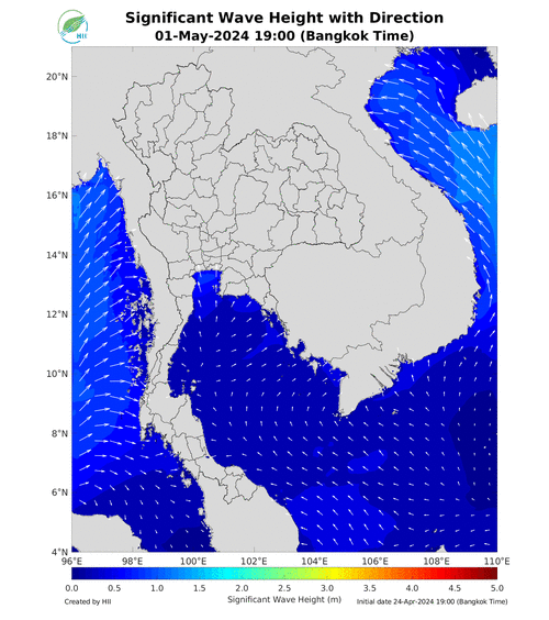
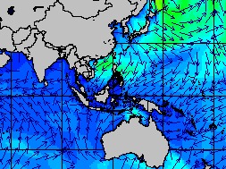
การติดตามและคาดการณ์สภาพอากาศจากค่าความสูงน้ำทะเลและอุณหภูมิผิวน้ำทะเล
แผนภาพคาดการณ์ฝนล่วงหน้า 7 วัน ความละเอียดสูงจากแบบจำลองสภาพอากาศ WRF-ROMS Model
โดยทั่วไปความแม่นยำของการคาดการณ์สภาวะฝนจะลดลงเมื่อระยะเวลาคาดการณ์ยาวขึ้น โดยจะมีความแม่นยำสูงสุดที่ 3 วันข้างหน้า ข้อมูลคาดการณ์สภาวะฝนเป็นผลงานในระยะวิจัยและพัฒนา โปรดใช้วิจารณญาณในการนำข้อมูลไปใช้
แผนภาพคาดการณ์ความสูงและทิศทางคลื่นล่วงหน้า 7 วัน ความละเอียดสูงจากแบบจำลองคลื่นทะเล (SWAN Model)